Must-Have Features of Effective Mapping Software
Data has become the backbone of decision-making across various fields. Mapping software stands out by transforming geographical information into actionable insights, enabling users to navigate the complexity of spatial data with relative ease. Whether for urban development, environmental monitoring, or optimizing supply chains, the ability to visualize and manipulate geographic data is instrumental in driving strategic decisions in many sectors.
Table of Contents:
- Key Takeaways
- Intuitive User Interface
- Diverse Data Integration
- Advanced Analytical Capabilities
- Customizable Visualization Options
- Real-Time Data Processing
- Collaboration and Sharing Features
- Robust Mobile Support
- High-Performance Standards
- Data Security and Privacy
Key Takeaways:
- An effective mapping software must offer an intuitive interface that caters to all levels of technical ability.
- Flexible data integration is vital; the software should be capable of working with diverse datasets from multiple sources.
- The software should encompass powerful analytical tools for in-depth spatial analysis and predictive modeling.
- Visualization options must be plentiful and customizable to convey complex data in clear, impactful ways.
- Real-time data capabilities ensure mapping software remains current and relevant in fast-paced environments.
- Collaborative features are essential for distributed teams and multi-stakeholder environments.
- Mobile support with comprehensive functionality is critical for fieldwork and on-the-go access.
- Performance should never be compromised, regardless of dataset size or analytical complexity.
- Data security and user privacy are paramount to protect sensitive information and maintain trust.
Intuitive User Interface
The user interface (UI) bridges complex spatial data and the user. It is essential for mapping software to feature an aesthetically pleasing UI that is functional and intuitive. The UI should facilitate effortless navigation through the software’s various capabilities, enabling users from novice to expert to harness their full potential without intimidation. An ideal UI would boast a balanced design that avoids clutter while providing quick access to many tools and functions. It should empower users to focus on analysis and decision-making rather than how to operate the software itself.
Diverse Data Integration
Given the variety and volume of geographic data produced today, a mapping software’s versatility in integrating numerous formats and sources is paramount. Addressing this diversity, the tool should facilitate the assimilation of satellite imagery, demographic data, sensor inputs, and personal data. A robust mapping application enables users to easily import and synergize these data types, allowing for a more enriched and nuanced analysis. This comprehensive incorporation of data sources enables the creation of rich, multidimensional maps that can address even the most complex inquiries.
Advanced Analytical Capabilities
Mapping software needs to offer more than basic visualization. Advanced analytical tools empower users to examine the spatial data at their disposal thoroughly. With features such as buffering, spatial querying, network analysis, and surface modeling, the software should be equipped to provide insights that can forecast trends, optimize routes, or identify spatial anomalies. These rich analytical capabilities elevate the software from a simple mapping tool to a sophisticated analytical engine that can inform policy, drive business strategy, and even aid emergency management.
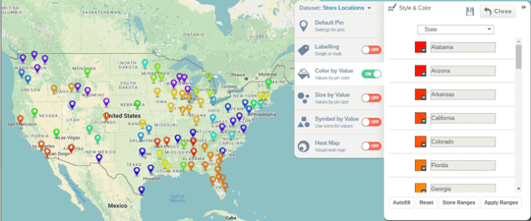
Customizable Visualization Options
Customization is key to translating spatial analysis into effective decision-making. Mapping software should afford its users complete control over the visualization process, offering a suite of options such as thematic mapping, 3D terrain modeling, and graduated symbolization. These tools enable the development of customized visual narratives tailored to specific audience needs, enhancing the communicative power of the maps created. Offering a diverse palette of visual customization ensures that the software can serve various applications, from scientific presentations to public policy briefs.
Real-Time Data Processing
The functionality of mapping software is significantly amplified when outfitted with real-time data processing abilities. Access to the latest information can influence critical decisions and actions in a rapidly changing world. This feature is particularly valuable in managing time-sensitive scenarios, such as responding to natural disasters or tracking logistics. Real-time data feeds should be incorporated seamlessly into the mapping environment, maintaining the software’s relevance and proving indispensable in operational contexts that demand immediate situational awareness.
Collaboration and Sharing Features
Collaboration is the cornerstone of modern work environments, and mapping software should cater to this need by embedding functionalities that allow for the sharing and co-editing maps and datasets. These collaboration features transform the software from an individual tool into a shared workspace that can facilitate dialog and ideation across teams or stakeholder groups. Cloud-based platforms, multi-user editing, and access control are all collaborative enhancements that should be integrated into leading mapping software.
Robust Mobile Support
As the workforce becomes increasingly mobile, the need for comprehensive mobile support in mapping software is clear. Users should expect a mobile experience that mirrors the desktop version, offering full functionality and an intuitive touch interface. Field personnel must be able to collect, view, and analyze data remotely without compromise. Moreover, mobile versions should offer offline capabilities for areas with unreliable connectivity, ensuring uninterrupted user productivity regardless of location.
High-Performance Standards
Efficiency and speed are essential attributes of any effective mapping software. Users working with large datasets or conducting complex spatial analyses require a platform that can deliver quick results without sacrificing accuracy or performance. The software should be optimized for fast processing and capable of handling intricate map rendering and data analysis tasks with minimal latency. High-performance standards are directly tied to user satisfaction and the software’s credibility as a reliable, professional tool.
Data Security and Privacy
Mapping software often deals with sensitive and private data, emphasizing the need for steadfast security and privacy measures. Strong encryption protocols, secure authentication mechanisms, and adherence to privacy laws and standards ensure user data remains confidential and safe from unauthorized access. Further, the software should be transparent about its data handling practices, reassuring users of the security of their information. A dedication to safeguarding data integrity builds trust and helps maintain the legitimacy and reputation of the mapping software in a data-conscious society.